LGU-STA. ELENA
Home
Progress On The Go
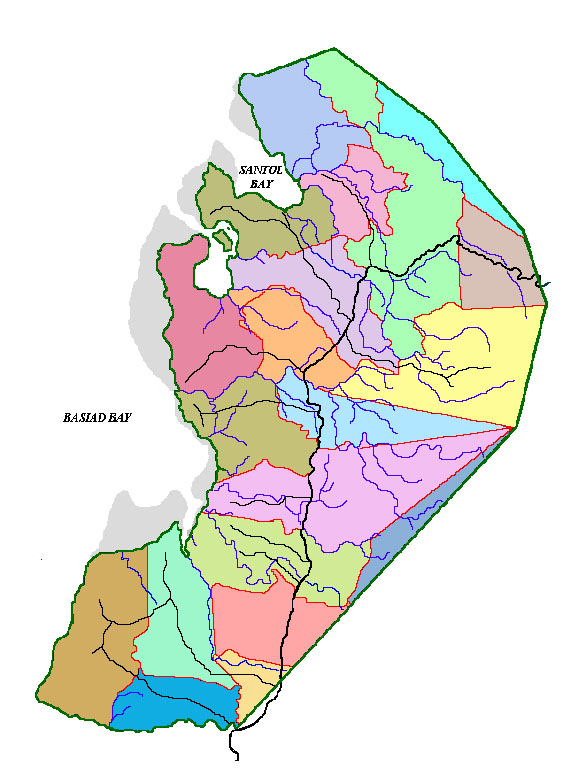
Sta. Elena lies at the frontier of the Bicol Region where one would not miss to set foot before one gets to Bicolandia. Situated on the northernmost part of the Bicol Peninsula, it is bounded north by the Municipality of Capalonga, south by the municipality of Calauag, Quezon, east by the municipality of Labo, Camarines Norte and west by the Basiad Bay of the Pacific Ocean. The town proper (Poblacion) is 263 kilometers from Metro Manila.
Sta. Elena is the eleventh of the twelve municipalities in the Province of Camarines Norte. It consists of nineteen barangays namely: Basiad, Bulala, Don Tomas, Guitol, Kagtalaba, Kabuluan, Maulawin, Patag Ibaba, Patag Ilaya, Plaridel, Pulong-guitguit, Rizal, Salvacion, San Lorenzo, San Pedro, San Vicente, Sta. Elena (Poblacion), Tabugon and Villa San Isidro.
The municipality of Sta. Elena comprised by nineteen barangays has a land area of 12,920 hectares. Barangay San Pedro having the least area and Barangay Villa San Isidro with the largest area most of where the remaining forest cover is situated. Sta. Elena has the seventh largest area province-wide and comprises 6.1% of the provincial area of 211,250 hectares.
Location & Boundaries


Comment/Suggestion: EMAIL @
fundy20@yahoo.com
"it's Brandy"
fundy20@yahoo.com
"it's Brandy"
!!!
My Blog Post
Tue, 15th September, 2009
You can post a comments here!....
Poblacion ~ Basiad ~ Bulala ~ Rizal ~ Salvacion ~ Pulong-Guit2x ~ San Lorenzo ~ San Vicente ~ Guitol ~ San Pedro Villa San Isidro ~ Don Tomas ~ Cabuluan ~ Kagtalaba ~ Maulawin ~ Plaridel ~ Patag Ilaya ~ Patag ibaba ~ Tabugon
Disclaimer
THIS IS NOT THE OFFICIAL WEBSITE
OF LOCAL GOVERNMENT UNIT OF STA. ELENA, CAMARINES NORTE
THIS IS NOT THE OFFICIAL WEBSITE
OF LOCAL GOVERNMENT UNIT OF STA. ELENA, CAMARINES NORTE
Please proceed to
www.santaelena-cn.gov.ph
www.santaelena-cn.gov.ph